File:Europa 1890.jpg

Diminzioni di st'antiprima: 766 × 599 pixel. Àutri risuluzzioni: 307 × 240 pixel | 614 × 480 pixel | 982 × 768 pixel | 1 280 × 1 001 pixel | 2 500 × 1 956 pixel.
Virsioni a àuta risuluzzioni (2 500 × 1 956 pixel, grannizza dû file: 1,84 MB, tipu MIME: image/jpeg)
Discrizzioni
| Descrizione |
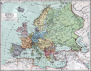
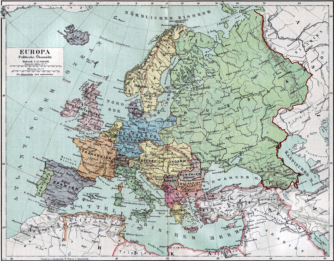
Politische Karte Europas ca. 1890 |
|||||
| Data | ||||||
| Fonti | Meyers Kleines Konversationslexikon. Fünfte, umgearbeitete und vermehrte Auflage. Bd. 1. Bibliographisches Institut, Leipzig und Wien 1892. | |||||
| Criaturi |
unbekannt, scan by sidonius 15:36, 7 November 2006 (UTC) |
|||||
| Pirmissu (Riutilizzari stu file) |
|
|||||
| Georeferencing | If inappropriate please set warp_status = skip to hide. | |||||
| Àutri virsioni | Derivative works of this file: Blank map of Europe 1890.svg |

_en.png)
.png)
.jpg)
Cronoluggìa dû file
Fari clic supra un gruppu data/ura pi vìdiri lu file comu si prisintava ntô mumentu nnicatu.
| Data/Ura | Miniatura | Diminsioni | Utenti | Oggettu | |
|---|---|---|---|---|---|
| currenti | 17:36, 7 nuv 2006 | | 2 500 × 1 956 (1,84 MB) | Sidonius | {{Information |Description=Politische Karte Europas ca. 1890 |Source=Meyers Kleines Konversationslexikon. Fünfte, umgearbeitete und vermehrte Auflage. Bd. 1. Bibliographisches Institut, Leipzig und Wien 1892. |Date=1892 |Author=unbekannt, |
Pàggini c'ùsanu sta mmàggini
Li pàggini siquenti richiàmanu sta mmàggini:
Utilizzu glubbali dû file
Puru li wiki appressu ùsanu stu file:
- Utilizzu supra bn.wikipedia.org
- Utilizzu supra de.wikipedia.org
- Utilizzu supra de.wikibooks.org
- Utilizzu supra en.wikipedia.org
- Utilizzu supra et.wikipedia.org
- Utilizzu supra fa.wikipedia.org
- Utilizzu supra fr.wikipedia.org
- Utilizzu supra hu.wikipedia.org
- Utilizzu supra it.wikipedia.org
- Utilizzu supra mk.wikipedia.org
- Utilizzu supra pl.wikipedia.org
- Utilizzu supra pnb.wikipedia.org
- Utilizzu supra sa.wikipedia.org
- Utilizzu supra skr.wikipedia.org
- Utilizzu supra uk.wikipedia.org
- Utilizzu supra ur.wikipedia.org